May 29, 2012
Credits: NASA/JPL/University of Arizona - Credits for the additional JP2 process.: Dr Gianluigi Barca/Lunar Explorer Italia/IPF; color.: Dr Paolo C. Fienga/Lunar Explorer Italia/IPF
|
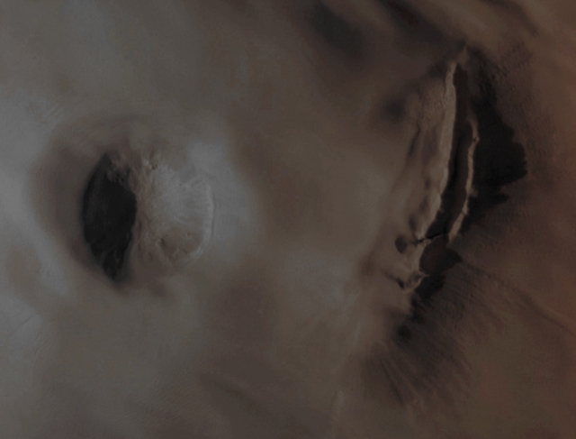
In today's APOD, the same Surface Feature we have shown you yesterday, but this time with a little more contextual visual information and the colorization in Absolute Natural Colors (a colorization that, as many of you have written, seems "extremely realistic"). Well, we, as IPF, wish to thank you so very much for your kindness, and, at the same time, we also invite you to study this frame (an EDM anyway), which, in our opinion, is another visual evidnece that the existence of some kind of Residual Volcanic Activity on Mars may not be just a speculation, but a fact. And, once the aformentioned assumpion is given, we wish to add that, among all the Martian Volcanoes that we have studied so far, Arsia Mons is (or, at least, appears to be) the "restless" one, especially for what we have seen happening in that Region in in the past few years. Unfortunately, even though the ESA - Mars Express Orbiter seemed to have "caught in the act" the occurrence of some (likely very powerful) Volcanic Activity at Arsia Mons (on the date of July, 2nd, of the AD 2009), no further information about that event (as well as about other possible Minor Volcanic Activities involving Arsia Mons) was ever released by the Major Space Agencies through the so-called Official Channels. And this means that, in the end, the only thing we can do now, is to keep observing and studying... Mars Local Time: 15:49 (Middle Afternoon) This frame has been colorized in Absolute Natural Colors (such as the colors that a human eye would actually perceive if someone were onboard the NASA - Mars Reconnaissance Orbiter and then looked down, towards the Surface of Mars), by using an original technique created - and, in time, dramatically improved - by the Lunar Explorer Italia Team.
|
News visualized: 659 times

