May 8, 2013
Credits: NASA/JPL/University of Arizona - Credits for the additional process. and color.: Dr Paolo C. Fienga/Lunar Explorer Italia/IPF
|
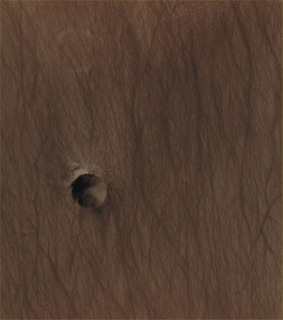
In this frame, taken by the NASA - Mars Reconnaissance Orbiter on March, 30, 2013 and showing us a small portion of the Southern Martian Region known as Hellas Planitia, we can see - litterally lost in a "Sea" of Sand that has also been heavily marked by the passage of a countless number of Dust Devils - two relatively small Unnamed Impact Craters which are going through two very different (and very distant, in terms of time) moments of their evolution. Barely visible, on the left (Sx) side of the picture, there is an extremely old and now almost completely "Buried Impact Crater", whose Rim, however, can still be discerned from the surrounding landscape; on the right (Dx) side of the frame, instead, a way more recent Unnamed Impact Crater that shows a very well defined (and therefore - of course, always relatively speaking - "fresh") Rim, with signs of a Landslide, that has occurred on its Inner Southern Slope, and also with what appears to be just a hint of a light-colored Windstreak on its Northern Outer Rim. Also a few Gullies can be spotted in several locations of the Inner Slopes of the Crater (particularly on its North-facing Inner Rim and Slope). Mars Local Time: 14:37 (Early Afternoon) This picture (which has been cropped from a NASA - Original Mars Reconnaissance Orbiter NON-Map Projected CTX b/w frame identified by the serial n. ESP_031292_1295) has also been additionally processed and then colorized in Absolute Natural Colors (such as the colors that a human eye would actually perceive if someone were onboard the NASA - Mars Reconnaissance Orbiter and then looked down, towards the Surface of Mars - Region of Hellas Planitia), by using an original technique created - and, in time, dramatically improved - by the Lunar Explorer Italia Team. |
News visualized: 641 times

